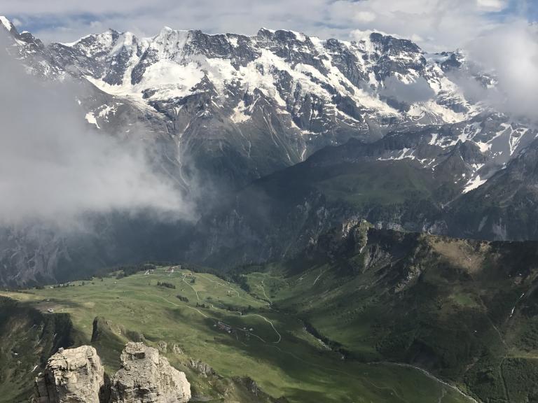
The valleys of Lauterbrunnen and Grindelwald sit nearby each other to the south of Interlaken, where I spent seven months of my mission.
I don’t know whether we of that era had much of an impact on Switzerland, but I can testify that Switzerland — and particularly this area, the Berner Oberland — had (and continues to have) an enormous impact on me.
(Wikimedia Commons public domain)
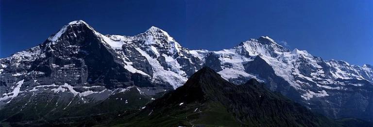
The Lauterbrunnen and Grindelwald valleys are dominated by a gigantic wall of mountains — ten kilometers across — including some of the biggest “northern walls” in the Alpine range. The most famous of the peaks are, running from east to west, the Eiger (13,020 ft; 3,970 m), the Mönch (13,474 ft; 4,107 m) and the Jungfrau (13,642 ft; 4,158 m). They’re far and away not the tallest mountains on Earth, but they begin at low elevations and rise abruptly, dramatically, spectacularly, from the glacial valleys at their bases. The Jungfrau, for instance, soars more than three kilometers vertically above the floor of the Lauterbrunnen Valley (which sits at only 800 meters above sea level) within just four horizontal kilometers.
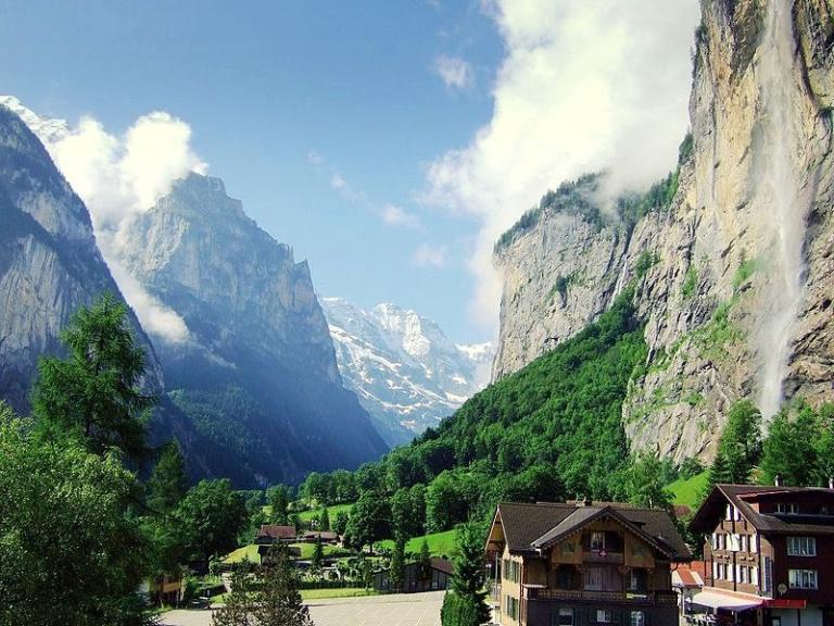
Probably my favorite place on Earth. When I first saw it, I thought, “This is now Tolkien’s Rivendell or Valley of Elrond, the home of the elves, must look.” It was only a few years ago that, reading something about Tolkien, I discovered that, as a matter of fact, he had patterned Rivendell on precisely this valley after a walking tour here. I suspect, too, that Caradhras, one of the mightiest and most dangerous peaks in Tolkien’s “Misty Mountains,” may have been inspired by the Jungfrau, or at least by one of the other mountains in the vicinity.
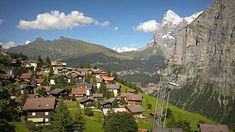
This is especially visible from in or near the village of Mürren, which we visited today en route via cable car, to Birg and the top of the Schilthorn.
(Wikimedia Commons public domain image)
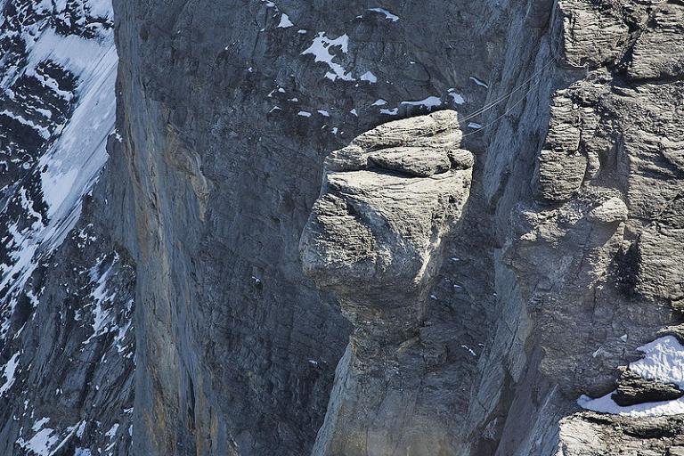
The Eiger Nordwand — its famous “North Face” or, more literally from the German, its “North Wall” — has killed at least sixty-four experienced climbers since 1935. Accordingly, in a German pun, it’s sometimes called the “Mordwand,” or “Murder(ous) Wall.”
As I type, I’m looking up at it from our balcony in Schwendi, Grindelwald.
The Alps are fascinating to me in every way. One of my resolutions is to learn more about their intriguing geology. They seem to have begun forming, so far as I’m aware, about three hundred million years ago, and — incredibly, but thanks to plate tectonics — they’re composed of continental European rock at the base, African rock near the peaks, and, in between, Tethyan or oceanic materials.
P.S. One of my more remarkable experiences while serving as a missionary based in Interlaken was to have tracted out, and spent a couple of hours talking with, Norman Dyrhrenfurth.
Posted from Grindelwald, Switzerland