Did you know that we’re approaching the first anniversary of the release of Pokemon Go? According to Wikipedia, its “extended launch” was on July 6, 2016, which seems about right, if you think back to all of the kids gathered around, phones in hand, at various parks and other public places at all times of day, this time last year, and all of the articles about how this was going to be a game-changer in getting kids to be active because the rules of the game required it.
Of course, at least around here, you don’t see all those kids, or really, any kids, playing Pokemon Go any longer. My son reports that, at his sailing (day) camp, there are a few kids that come by who are visibly playing the game, and he reported that some of his friends played it during their Washington D.C. trip, though it wasn’t quite clear to me (and I couldn’t get a clear answer from him on this point, either) whether this was because there were new Pokemon they could catch that weren’t possible locally or if it was just the novelty of playing in D.C. (My son has a relatively “dumb” smart phone, that is, without a data plan, so he’s never played himself, and now also says, anyway, that it’s a fad that his friends with data-enabled devices have lost interest in anyway.)
But here’s the thing: Pokemon Go only works to get kids active if they’re allowed to leave the house and, under their own power, get to Poke-stops, so I found a site that allowed me to look at all possible Poke-stops,
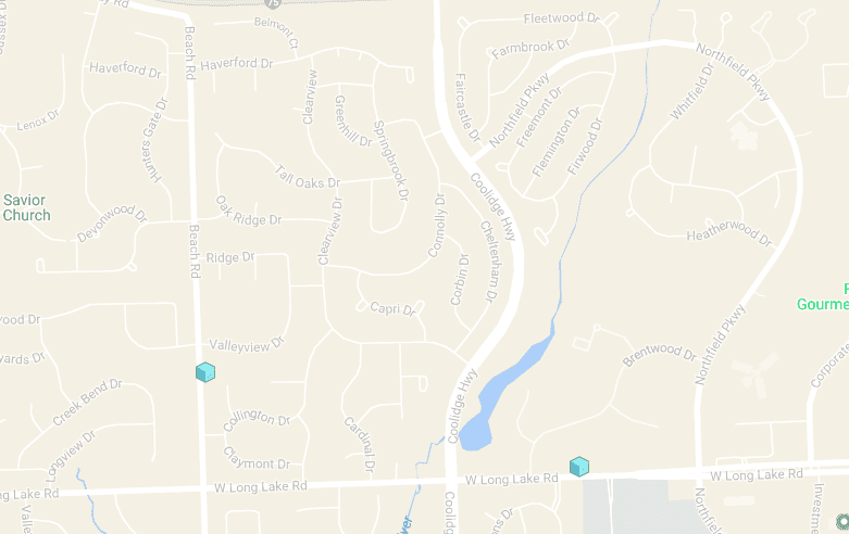
Here’s a map of the various Poke-stops near my home:
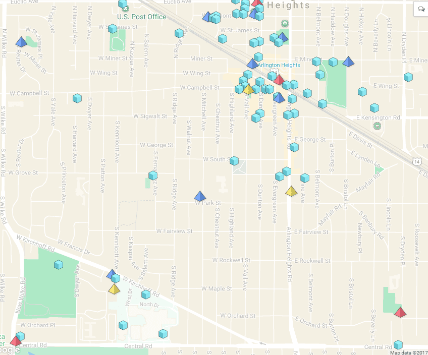
The cluster in the top right is the downtown area of our suburb; as you can see, our neighborhood is older and more traditional, with a traditional, city-like grid, and the diagonal in the top right is the commuter line into the city.
Here’s a map of the various Poke-stops near the house I grew up in:
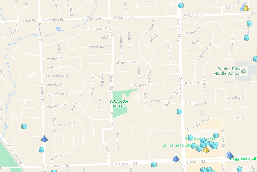
The cluster at the bottom right is the shopping mall. If I’d gone a mile or two north, there would have been many fewer, e.g,
Here are the Pokestops in my brother and sister-in-law’s neighborhood, in far suburban Milwaukee:
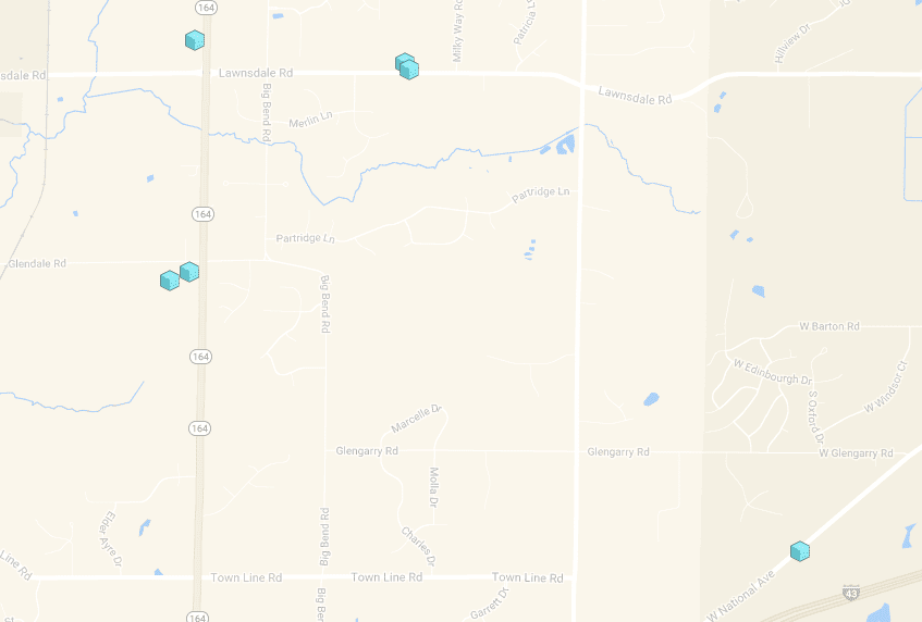
Now, one thing I’ll admit that I’m not sure that the scale on all of these images is consistent. And, yes, as readers will have noticed by now, I am a total nerd about maps. But it seems to me that kids growing up in the generic cookie-cutter suburbs, where every subdivision has an entrance from a main road, and where cars are required to get pretty much anywhere, would have a pretty difficult time playing the game, and all the more so if they’re helicopter-parented, and not allowed to cross busy streets — unless, I suppose, those same parents drive them to more Pokemon Go-friendly destinations.
Image: From Pixabay; https://pixabay.com/en/pokemon-pokemon-go-phone-game-1553995/; public domain