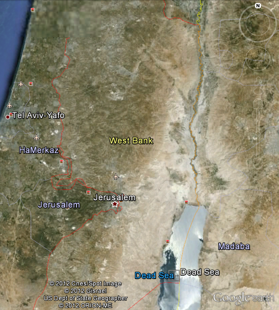
In my Sunday school class today we talked about Israel and Palestine, as this was my first Sunday in church since my trip. Because the question of distances between places came up, someone in the class looked up Israel on Google Earth. As a result, we all got to see something that one can see on the ground, but which seems to me to come across even more poignantly in the satellite image. The investment and distribution of resources between Israel and the West Bank (in terms of irrigation and “greenification”) shows up so clearly that one wouldn’t need the armistice line drawn in to be able to see it. See for yourselves, whether here or on Google Earth: