Compare Matthew 4:24-25; 12:15-16; Luke 6:17-19
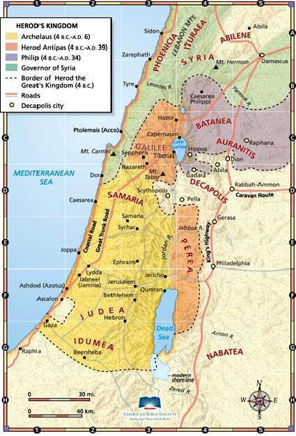
The accounts of healings given in the passages cited above mention people coming from Galilee, Idumea, Tyre and Sidon, the Decapolis, Jerusalem, and Judea, and from what used to be called Transjordan (that is, the area across the Jordan River, in what is today the Hashemite Kingdom of Jordan, which was itself known as Transjordan even into the twentieth century). “His fame spread throughout all Syria,” says Matthew 4:24.
I’m map-obsessed. And I hope that you are, too. At least a little bit.
Maybe you know all these places already. But let’s go through them, starting in the north:
Phoenicia runs along the Mediterranean coast, where the two cities of Tyre and Sidon are still major urban areas (in the country of Lebanon) to this day. Inland, to the east, is the area known as Galilee, of crucial importance for the ministry of Christ and the biographies of his apostles. The most obvious feature in Galilee is the large freshwater lake that’s often called, for obvious reasons, the Sea of Galilee. Both Nazareth, where Jesus was raised, and Capernaum, where he established his base of operations (to the extent that he had one), are in Galilee.
The Jordan River flows roughly to the southwest from its source at Caesarea Philippi, up in Batanea (toward Syria), at the foot of Mount Hermon. It feeds into the Sea of Galilee at its northern end, and then flows due south from the southern tip of the Sea of Galilee to the northern tip of the Dead Sea. It divides Judea from Perea, and, today, divides Israel from the Hashemite Kingdom of Jordan to the east.
To the southeast of the Galilee is the area known as the Decapolis (Greek for “ten cities”). They didn’t constitute a formal league or anything of that sort, but were more or less autonomous city-states grouped together for geographical and cultural reasons. The standard list of the ten cities that were included within the Decapolis is as follows:
1. Gerasa (modern Jordanian Jerash, an extraordinarily impressive archaeological site and tourist destination, modern location of a famous annual cultural festival)
2. Scythopolis or Beth-Shean (located in modern-day Israel, the only city of the Decapolis situated west of the Jordan and, again, an extremely impressive set of ruins that tourists often visit [come with us sometime!])
3. Hippos (in modern Israel, on the eastern shore of the Sea of Galilee [we’ll point it out as we drive by])
4. Gadara (in modern Israel; think of the “Gadarene swine”)
5. Pella (in modern Jordan)
6. Philadelphia (modern-day Amman, the capital of the Hashemite Kingdom of Jordan, which was known in Old Testament times as Rabbath-Ammon)
7. Capitolias (in modern Jordan)
8. Canatha (in modern Syria)
9. Raphana (in modern Jordan)
10. Damascus (the capital of modern Syria)
Jerusalem and nearby Bethlehem are roughly in the hilly center of Judea to the south, and Idumea is south of Judea.
Classically, the entire area covered by today’s Lebanon, Syria, Jordan, and Israel was often known as Syria. That’s why Matthew 4:24 says that Jesus’ fame spread throughout all of Syria.
***

(Wikimedia Commons public domain image)
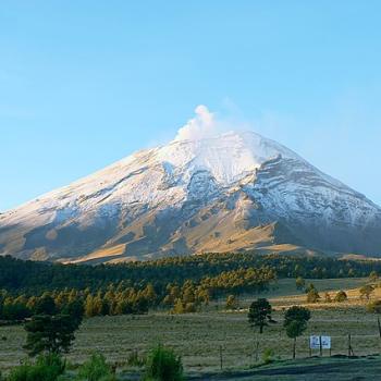
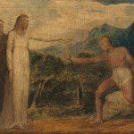
In the biblical account of Moses, that prophet goes up onto a mountain to receive instruction and to be given his commission from the Lord.
I think it not coincidental that, in these New Testament accounts, Jesus climbs a mountain and, from there, gives instruction to his disciples and commissions twelve of them as apostles.
There is, in my judgment, powerful symbolism in the topography.
Posted from Richmond, Virginia