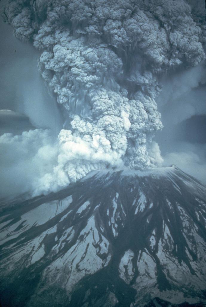
I return to Jeff Wynn and Louise Wynn, Everyone is a Believer: The Growing Convergence of Science and Religion (2019). Dr. Jeffrey C. Wynn, a former atheist who converted to the Church of Jesus Christ of Latter-day Saints, is a research geophysicist with the United States Geological Survey (USGS). He is currently based at the Cascades Volcano Observatory in Vancouver, Washington, one of the five USGS volcano observatories in the United States. His wife, Louise Wynn, is a writer whose research for her master’s degree focused on the Pumice Plain or “Blast Zone” of Mount St. Helens. In other words, they have specific expertise that, umm, surpasses even that of the typical anonymous internet critic of the Church of Jesus Christ of Latter-day Saints.
Here are a couple of extracts from their book:
the surprising similarity of details in 3 Nephi 8 to the events surrounding the 1980 eruption of Mount St. Helens. . . . To a professional volcanologist, this chapter accurately describes a cataclysmic volcano-tectonic event on a major subduction zone. Yet volcanoes, earthquakes, subsidence, and allocthons are geological phenomena that don’t exist within 3,000 kilometers of western New York State, nor were they known to any Americans in 1828. (35)
These geological phenomena were certainly foreign to Joseph Smith’s childhood and youth in Vermont and New York State:
Western New York is covered with glacial moraines — huge gravel and boulder piles shoved down from their origins in Canada by the glaciers that retreated with the Younger Dryas epoch about 11,700 years ago at the end of the last Ice Age. Cumorah, the hill where Joseph found the golden plates that he translated as the Book of Mormon, is one of these glacial moraines. Joseph Smith had never seen a volcano nor felt an earthquake in his short life. A primitive form of the field of volcanology existed at the time, mainly in Italy around Vesuvius, Etna, and Stromboli volcanoes, but Pompeii and Herculaneum had not yet been seriously excavated. Tectonics as a scientific field would not develop until more than a century later. (35)
For a previous post on this subject, also based on the Wynns’ book, see
“Mount St. Helens and the Book of Mormon”
For links to a previous series of posts on the geology of the catastrophe described in 3 Nephi, see:
“Krakatoa, a Comparison, and a Concordance”
***
On 8 March 2020, Brother Wynn gave what has turned out to be the last sacrament meeting talk given in his ward thus far this year. Just today, he posted that talk on his website, at www.ldsscientist.com:
“The First Vision – More significant than you might think”


