Students attending English-speaking schools in the Muslim-majority Gulf region will learn geography from Atlases which do not include the nation of Israel.
In the Middle East version of the Atlas, Jordan and Syria extend all the way to the Mediterranean Sea. Including Israel, says the publisher’s map-publishing subsidiary Collins Bartholomew, would have been “unacceptable” to their customers in the Gulf. Instead, maps in the new version incorporate “local preferences.” While Israel is not shown on the map, it does include the West Bank.
According to a report in The Tablet, the Bishops Conference of England and Wales has
“…accused the publisher HarperCollins of harming peace efforts in the Middle East through its production of atlases that omit Israel from their maps.”
Bishop Declan Lang, chairman of the Bishops’ Conference Department of International Affairs, said in an interview with The Tablet,
“The publication of this atlas will confirm Israel’s belief that there exists a hostility towards their country from parts of the Arab world. It will not help to build up a spirit of trust leading to peaceful co-existence.”
HarperCollins reported that in the past, one Gulf country has refused to permit Atlases to enter their country until the nation of Israel had been manually erased from view.
* * * * *
BREAKING NEWS UPDATE
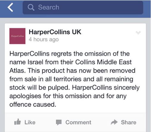
December 31, 2014: HarperCollins today apologized for omitting the nation of Israel from its Middle East Atlas, which is sold to English-speaking schools in the Arab Gulf. After receiving angry criticism from Jewish and Christian leaders, the publishing house has removed the remaining stock from shelves.
In a statement, they promise that all remaining stock will be destroyed.


